


Nembe-Brass Road: A Long Road to Hope, Jobs and a New Future for Bayelsa’s Riverine Communitie
By Crystalnews Admin
For generations, residents of communities scattered across the riverine creeks of Bayelsa State have watched roads being built in other parts of the country while their own communities remained largely dependent on boats.
For them, travelling from one community to another has never been as simple as boarding a vehicle and driving along a paved road.
It often means waiting for a boat, paying expensive fares, navigating through waterways and, in some cases, worrying about the safety of passengers and goods.
That reality is gradually changing with the renewed construction of the long-awaited Nembe-Brass Road.
For communities in Nembe and Brass Local Government Areas, the road is more than a stretch of asphalt, bridges and concrete structures.
It represents a possible escape from decades of isolation and a chance to connect directly with the wider economy of Bayelsa State and Nigeria.
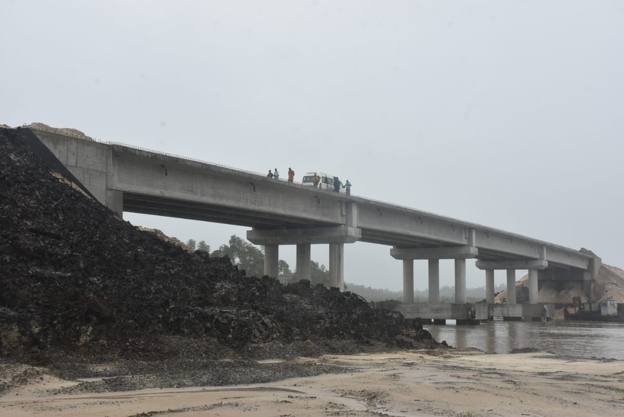
During an inspection of the project corridor by members of the Federated Correspondents Chapel of the Nigeria Union of Journalists (NUJ), Bayelsa State Council, significant construction activities were observed at different sections of the first phase.
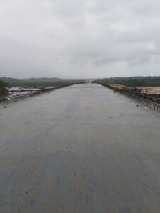
Earthworks, bridge construction and other engineering activities were ongoing, with the route advancing towards the St Nicholas River and the coastal axis.
For residents who have waited for decades, the sight of heavy construction equipment and emerging road infrastructure is a powerful reminder that a project once regarded by many as almost impossible may finally become reality.
‘This road can change everything’
For HRH King Theophilus Moses, the Kenibara VII and Amadabo of Moko-Ama in the Sangana/Akassa area of Brass Local Government Area, the project could have consequences far beyond transportation.
He described the Nembe-Brass Road as one of the most economically viable projects undertaken by the government, arguing that its completion could open up the marine economy of the area.
According to him, the absence of adequate berthing facilities has forced vessels operating in the area to travel to places such as Bonny for berthing and refuelling.
With improved road infrastructure and the potential development of supporting marine facilities, he believes Brass could emerge as an important centre for marine activities.
He said such development could create jobs, expand businesses and increase economic activities along the entire value chain.
For the traditional ruler, the road could therefore become a catalyst for the development of the much-talked-about blue economy in Bayelsa.
But beyond economic calculations, he sees another possible benefit: security.
King Moses linked the persistence of sea piracy partly to economic deprivation and unemployment, arguing that when young people have legitimate employment opportunities, the incentive to engage in criminal activities could diminish.
He also pointed to the role of Tantita in reducing sea piracy and providing employment opportunities in the Niger Delta.
His expectation is that increased economic activity arising from the road, combined with employment opportunities, could help make sea piracy a thing of the past.
But not everybody feels included
While the project has generated excitement across the region, some residents believe that the benefits may not be evenly distributed.
For Ayibatonye Koki, an indigene of Sangana, the road is undoubtedly a welcome development, but there is a major concern about the connection between Sangana/Akassa and the road corridor.
Koki said residents of the Sangana axis could still face high transportation costs because they would have to pay substantial fares to reach Brass before joining the new road.
“It’s a good development, a very good development,” he said, stressing that the road would provide a much-needed connection to the Atlantic from that part of Bayelsa.
But he added that residents of the Akassa axis were worried that they might not benefit as much as expected.
Although Brass is the headquarters of the local government and relatively close to Sangana geographically, Koki said transportation costs could make the journey almost as expensive as travelling to Yenagoa.
For communities that have spent years struggling with high transportation costs, this is not a minor concern.
It means that a road can be physically close and still remain economically distant.
The rivers that stand between communities
One of the biggest challenges is geography.
The Niger Delta terrain is not ordinary terrain. Rivers, creeks, mangrove forests and islands dominate the landscape, making conventional road construction extremely expensive and technically demanding.
Koki explained that anyone attempting to connect Brass directly to Sangana or Akassa would have to contend with major waterways, including the Brass River and the River Nun around the Akassa axis.
He likened the scale of such bridge construction to some of the massive bridge projects in Lagos.
That, he argued, is why communities in the Sangana/Akassa axis are looking towards another possible route: the Oporoma Road in Southern Ijaw.
According to him, linking Sangana/Akassa through the Bayelsa Central axis could be easier and potentially cheaper because the route would involve smaller creeks rather than major rivers.
He believes the government could construct smaller bridges across the creeks and gradually connect the island communities to the Atlantic.
For residents, therefore, the current Nembe-Brass Road is both a source of hope and a reminder of what remains undone.
“We are only hoping that they will consider us,” is essentially the message coming from communities that fear being left on the other side of the development divide.
A road that could bring jobs closer
The potential impact of the project extends beyond transport.
For Janet Tuomote, an indigene of Nembe Local Government Area, the road represents an opportunity for employment, business expansion and greater exposure for the people.
She believes improved road access could bring more businesses into the area, strengthen economic activities and create opportunities for young people.
The opening of communities that have traditionally been accessible mainly by water could also make it easier for security personnel to move around the area.
Tuomote believes improved access could help reduce sea piracy and kidnapping because security agencies would have greater ability to protect lives and property.
That expectation is particularly significant in communities where insecurity has historically affected movement, commerce and investment.
More than a road
The story of the Nembe-Brass Road is not simply about construction.
It is about people who have spent decades asking why communities rich in natural resources remain difficult to reach by road.
It is about fishermen, traders, farmers, civil servants, students and families who have had to structure their lives around the waterways.
It is also about young people who need jobs and businesses that require reliable transportation to survive.
The road is designed to provide an all-road connection to Brass Local Government Area and reduce the region’s longstanding dependence on waterways.
The first phase currently under construction covers about 21 kilometres. It has been projected for completion around December 2026, although the actual delivery date will depend on the pace of construction, funding and the challenges posed by the terrain.
Importantly, the 21-kilometre section should not be interpreted as the completion of the entire Nembe-Brass road corridor.
Governor Douye Diri had stated in 2025 that the Federal Government had awarded Phase Two, while further indications of Federal Government support emerged in 2026.
The continuation of the project will therefore be critical if the road is to achieve its full objective of connecting the communities and integrating Brass more effectively into Bayelsa’s wider transportation network.
A promise decades in the making
The Nembe-Brass Road has a long and complicated history.
The idea of connecting the communities by road predates the present administration, with accounts tracing plans for the project back several decades, including references to an earlier contract dating to 1943.
Successive administrations made attempts to revive the project, but the enormous cost of constructing roads across the Niger Delta terrain repeatedly frustrated efforts to deliver it.
Funding, difficult geography, security concerns and the complexity of building bridges across waterways have all contributed to the project’s long delays.
The present construction therefore carries a significance that goes beyond the administration currently implementing it.
It is an attempt to transform a decades-old promise into physical infrastructure.
The questions that remain
Yet, as construction gathers momentum, residents and stakeholders say the government must begin looking beyond the visible structures.
Questions remain about the precise arrangements for the next phase, funding, the connection of communities that may not directly benefit from the first phase and the long-term maintenance of the road.
There are also concerns about the environmental consequences of constructing infrastructure across one of Nigeria’s most delicate ecosystems.
For communities affected by the project, proper engagement, compensation where applicable and environmental protection will be as important as the road itself.
Security remains another concern.
Governor Diri had previously warned against alleged attempts to frustrate the project through threats to workers, underscoring the need for continued protection of the construction corridor.
As of the time of filing this report, the Bayelsa State Commissioners for Works and Infrastructure, Moses Teibowei, and Information, Ebiowuo Koku Oboyai, had not provided further clarification on the current funding arrangements, the precise status of the subsequent phases or the detailed plan for connecting the remaining communities.
From isolation to opportunity
For now, however, the machines continue to work.
Bridges are rising. Earthworks are progressing. The road is gradually pushing through a landscape where water has historically dictated how people move.
And for residents watching from the communities, every completed section carries a message.
That message is hope.
Hope that a child from Brass or Nembe will one day be able to travel by road without depending entirely on a boat.
Hope that traders will move goods more cheaply.
Hope that businesses will come.
Hope that young people will find jobs.
Hope that improved security will follow improved access.
And hope that Brass, with its strategic position along the Atlantic, can finally begin to realise its potential as a major economic and marine hub.
But for that hope to become reality, residents say the government must ensure that the road does not stop where construction currently ends.
The real test, they argue, is whether the project will ultimately connect the people who have waited the longest—and whether the road will become not just a monument to government construction, but a pathway to jobs, security, investment and a better life.
